
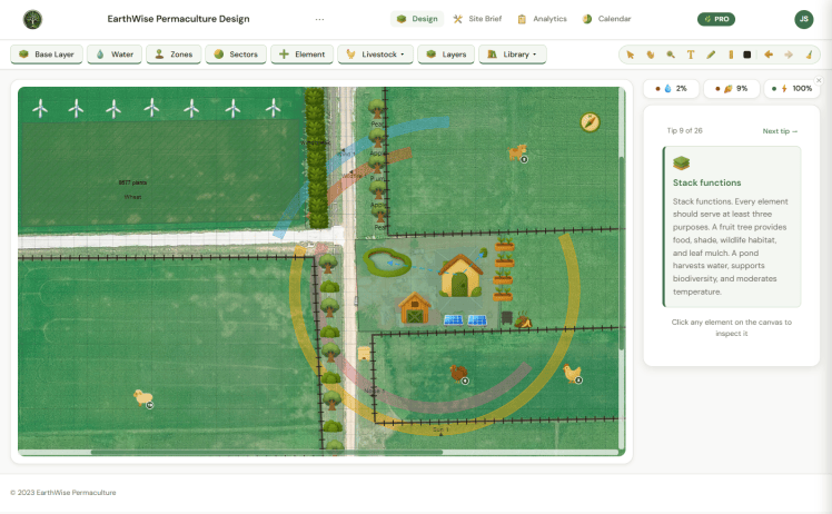
There’s a moment every permaculture designer knows well
You’re standing on a piece of land and you can see it. The food forest in the back corner. The water harvesting swale along the slope. The guild plantings around the fruit trees. The whole living system, interconnected and productive and thriving.
And then you sit down to actually plan it and the vision starts to fall apart.
You pull out a notebook. You sketch some rough zones. You open Google Earth. You start a spreadsheet for your plant list. You have seven browser tabs open trying to cross-reference sun angles, companion planting relationships, and rainfall data. The whole beautiful system that was so clear in your head is now scattered across four different tools and a pile of paper that doesn’t quite capture any of it.
I’ve had that experience more times than I can count. And for years I just accepted it as part of the process.
Then one day I stopped accepting it and started building something better.
Why I Built EarthWise
My name is Joel. I’ve been doing permaculture design work for years and I love this work. The systems thinking, the observation, the slow satisfaction of watching a well-designed landscape come into its own over time.
But I’ve always been frustrated by the gap between how permaculture designers think and the tools available to us. Most garden planning apps treat plants as isolated objects on a grid. Professional GIS tools are powerful but built for engineers, with a learning curve that takes months and a price tag to match. Nothing in between was built specifically for this work.
So I built it myself.
It wasn’t a smooth journey. It was iterative, sometimes frustrating, occasionally exhilarating, and full of moments where I seriously questioned whether I was the right person to do this. I’m a permaculture designer, not a software developer. But the thing that kept me going was simple: I knew this needed to exist.
What EarthWise Actually Does
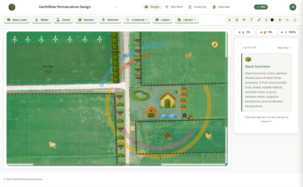
EarthWise is a visual permaculture design tool for gardeners, homesteaders, designers, and anyone who wants to plan their land with more clarity and confidence. Here’s what’s inside:
Design Canvas
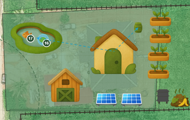
Draw zones, sectors, and elements directly onto an aerial view of your actual property. Place plants, trees, water features, structures, livestock, and energy systems exactly where they belong. The library includes over 300 species tagged by function, plus support for custom species and icons. Freehand drawing, notes, labels, keyboard shortcuts, and full undo/redo are all included.
Zones and Sectors
Draw zones as polygons, circles, or rings — or drop the classic Permaculture Zones 0 through 5 preset in one click. Zone Health scoring evaluates your design against real permaculture criteria. Sector overlays cover sun, wind, water, noise, wildlife, wildfire, pollution, and people movement.
Water Systems
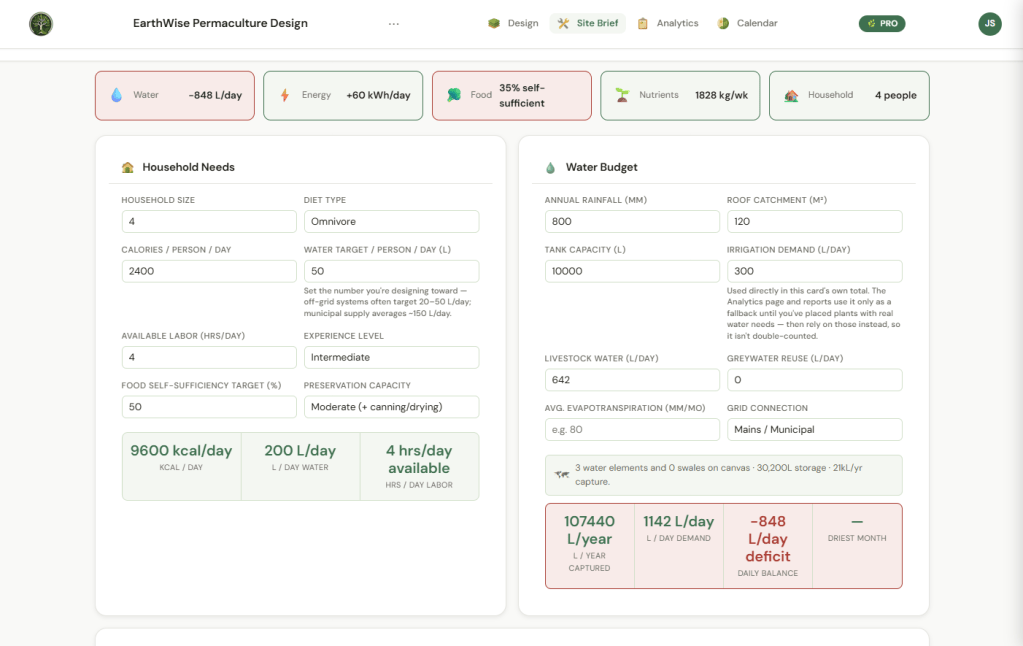
Map directional water flow across your site. EarthWise automatically calculates your full water budget — roof catchment feeding ponds, tanks, and cisterns, plus wells and rivers as sources. Household, livestock, irrigation, and plant demand are all weighed against your total capture. You see your surplus or deficit in real time as you design.
Energy Systems
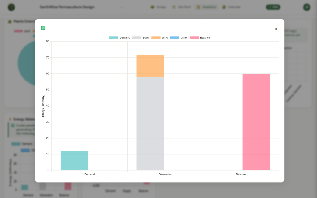
Place solar panels or wind turbines and get physically modeled output estimates based on your actual location and local climate data. Load versus generation analysis shows your energy balance with actionable suggestions when demand exceeds supply.
Guilds and Companion Planting
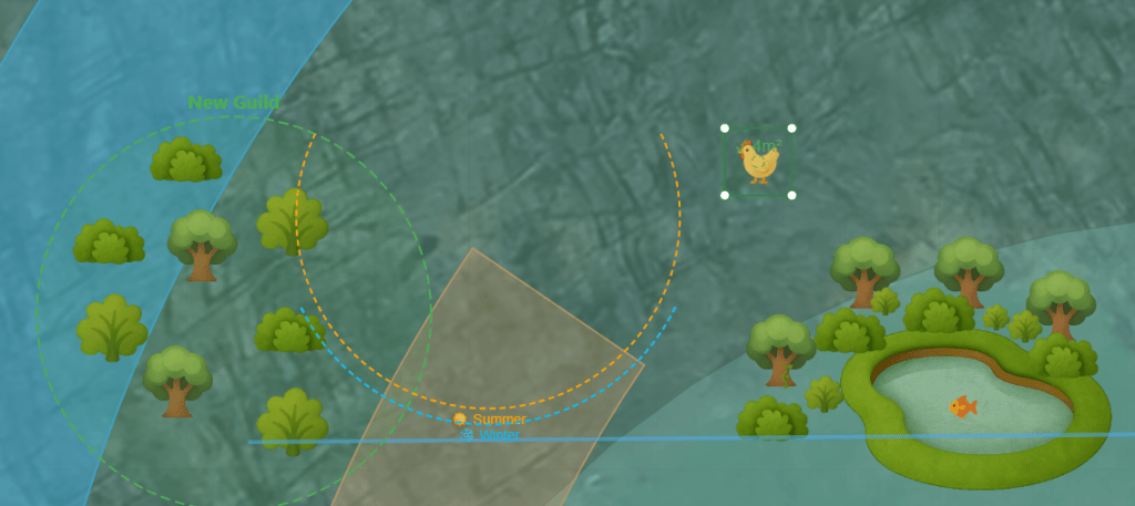
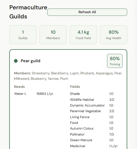
Group plants into guilds and get combined water, nutrient, and yield totals calculated automatically. Companion planting conflict and synergy detection flags known incompatible pairings before you commit to them.
Automated Design Gaps
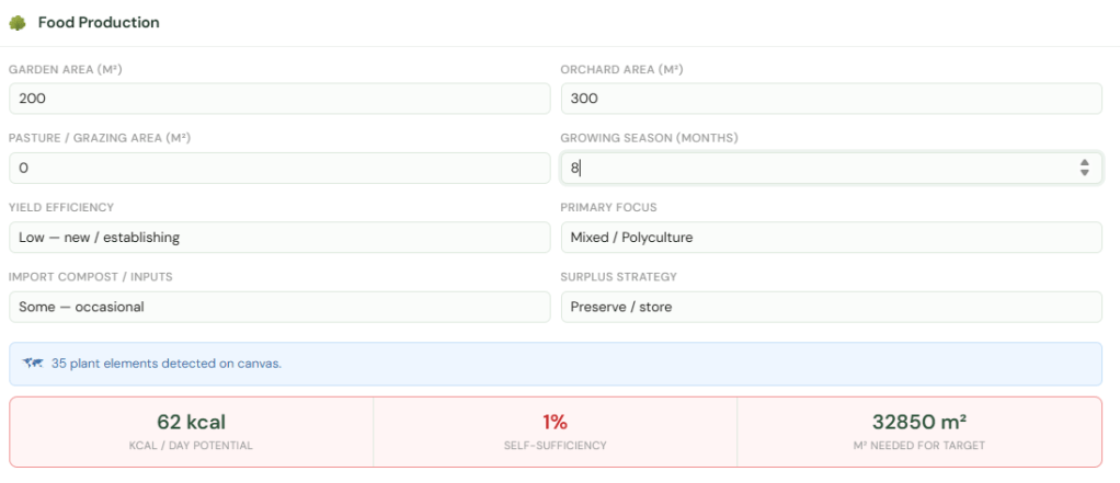
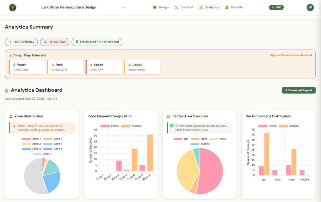
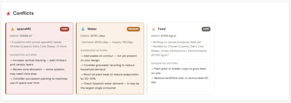
As you design, EarthWise reviews your layout against real permaculture criteria and flags what’s missing — with severity levels and specific suggested fixes. It catches design problems while you draw, not after you’ve finished.
Analytics and Yield Tracking
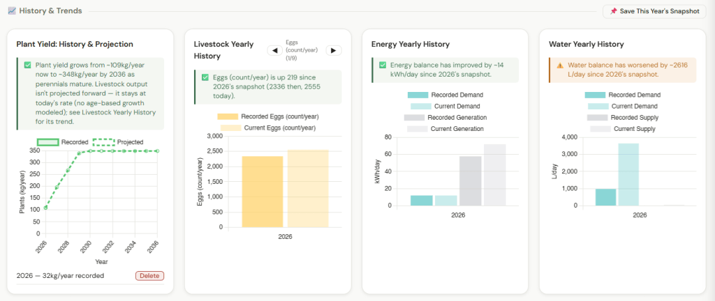
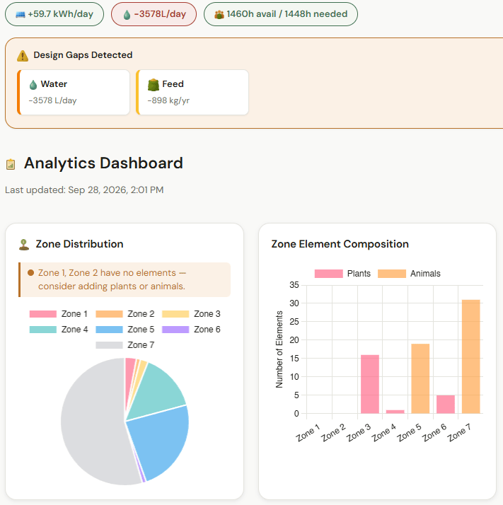
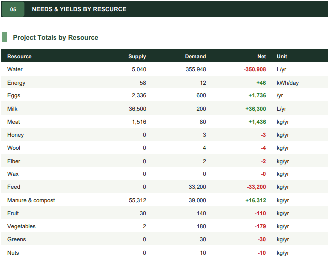
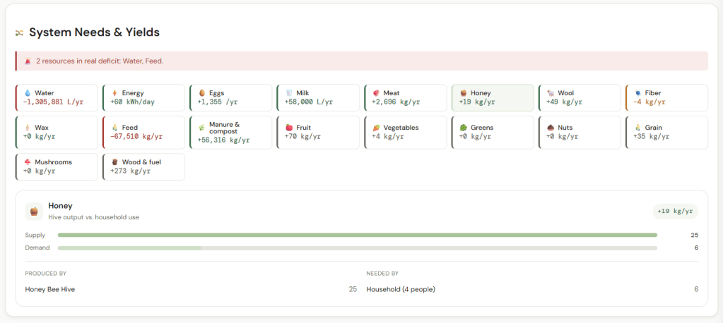
Yield, resource balance, and zone productivity charts with plain-language callouts. Supply versus demand tracking across 15 resource types including water, energy, eggs, milk, honey, fruit, and grain. Food forest growth projection shows how your system evolves as trees and shrubs mature over 5, 10, and 20 years.
Planting Calendar
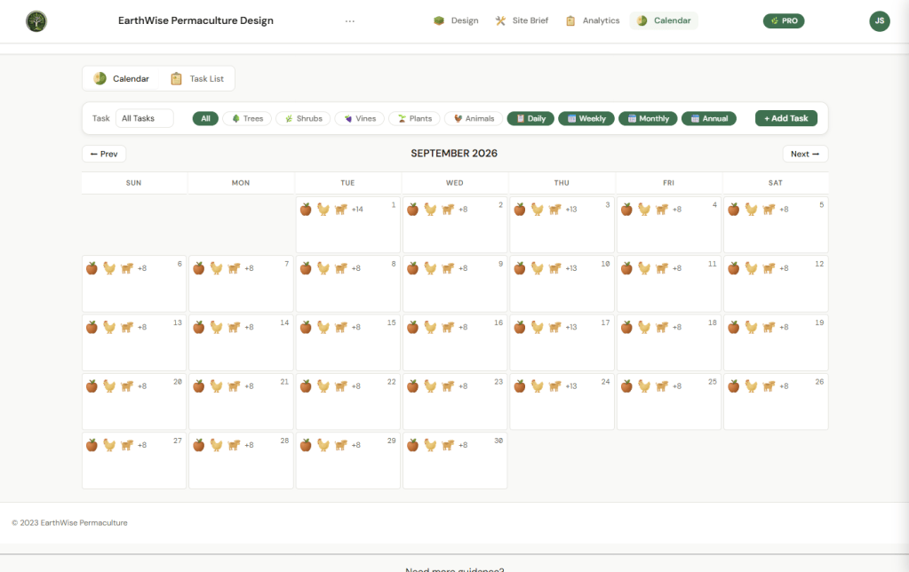
Auto-generated planting and harvest windows based on real frost dates for your exact location. A livestock care calendar covering laying peaks, breeding windows, honey harvests, and rotation reminders — all driven by real NASA and Open-Meteo climate data.
Pro Features
Branded PDF reports for client deliverables. KML and GeoJSON export that opens directly in Google Earth. Version history with up to 5 saved versions per project. Multi-account sharing with Owner, Editor, and Viewer roles for client collaboration. Blueprint mode for clean schematic views.
It’s Live Today
EarthWise is available right now at app.earthwisepermaculture.ca.
Try it free — no account required, no credit card, no pressure. Open it and start designing. When you’re ready to save your work and unlock full access, lifetime access starts at $65 CAD.
If you’ve been following this journey — thank you. The comments, the messages, the encouragement through the Kickstarter campaign and everything that followed — it kept me going through the hard days more than you know.
Follow along at @EarthWiseCA on Instagram and get started at app.earthwisepermaculture.ca

